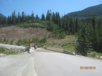
We headed west on the BC Route 99, The Sea to Sky Highway. Incredible curvy road with glacier rivers, snow capped mountains, mountain lakes, deserts and huge valleys that we wound through about 190 miles with just a few first nation villages (kinda like American Indians) which are economically in better shape than our Indian villages. We noticed Canada has different prices for the native Americans, nine cents a liter ($.45/gallon) cheaper for fuel.
The last 40 miles of the ride to Vancouver picked up speed and traffic on a road that is mostly bridges along the side of the mountain, looking at Victoria, Ocean going ships, fishermen and private boats. We hit Vancouver and exited without a map in 4 PM traffic which wasn't fun. We headed to the border and made the first exit to a campground on Puget Sound. (I'll Add pictures later).
We are looking at plans for the next couple of days, I was thinking of an Iron butt ride to get home to my honey for our 43 anniversary Monday, but probably will stick to the plan and head for Yellowstone. Betty told to ensure I had plenty of food in my tent in Yellowstone, what's that about?
Sign means Hang on and brake hard!


No comments:
Post a Comment